Buffalo Niagara International Airport (BUF)
Driving Directions / Travel by Car
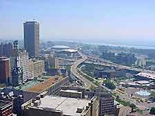
(Buffalo, New York - NY, USA)
Driving to and from the Buffalo Niagara Airport (BUF) is made easy by the convenient positioning of the main Boston to Cleveland I-90 (New York State Thruway / Gov. Thomas E. Dewey Thruway). Also nearby is the Kensington highway, which goes direct from Niagara's airport to downtown Buffalo.
Local towns close to Buffalo Airport include Williamsville to the north, Cheektowaga to the south, and Bowmansville to the east. Around the perimeter of the complex you will find the Aero Drive, Holtz Drive, Genessee Street (US-33), Cayuga Road and Wehrle Drive.
Directions to Buffalo Niagara International Airport (BUF) from the north:
- Head south and southeast towards Buffalo on I-190 and I-290
- Merge with I-90 south and take Exit 51 east onto Kensington Expressway
- Continue east and merge with Genesee Street for the airport
Directions to Buffalo Niagara International Airport (BUF) from the south:
- Take I-90 north
- Take Exit 51 east onto Kensington Expressway east
- Merge with Genesee Street for the airport
Directions to Buffalo Niagara International Airport (BUF) from the east:
- Take I-90 west
- Take Exit 49 (south) onto Highway 78
- Turn right onto Genesee Street for access to the airport
Directions to Buffalo Niagara International Airport (BUF) from the west:
- Take Kensington Street (Highway 33) from the west and downtown
- Continue east towards I-90 and merge with Genesee Street for Buffalo Airport
All roads near Buffalo Niagara International Airport can become congested during rush hour times, especially during the holidays, including I-90, I-290 and I-190, as well as Highway 33.
Buffalo Niagara International Airport (BUF): Virtual Google Maps
